WIFI and Cellular Infrastructure Planning

In this project, my focus was on utilizing Google Graphical Information to facilitate infrastructure planning, specifically for cellular and Wi-Fi networks. Here are the key aspects of the project:
Infrastructure Planning:
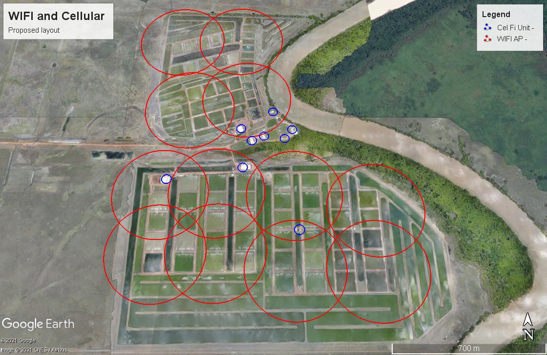
- The project involved the use of Google Graphical Information to plot and analyze the range and overlap of cellular and Wi-Fi signals.
- This planning phase was crucial in ensuring optimal network coverage and performance during the implementation of the network project.
Benefits:
- The Google Graphical Information served as a valuable planning tool, providing insights into signal coverage and potential areas of improvement.
- It served as a visual aid, allowing stakeholders to better understand the network layout and identify any potential issues.
- Documentation was enhanced as visual representations provided a clear record of network planning decisions and configurations.
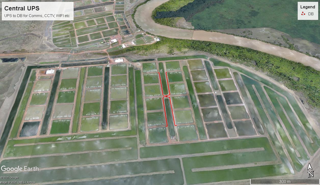
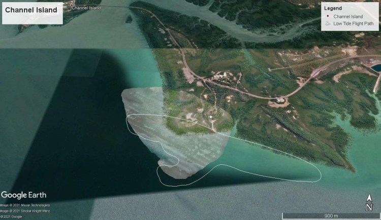
Components:
- DroneDeploy was used to capture aerial data, providing an accurate representation of the physical environment for planning purposes.
- webODM was utilized for processing and analyzing the drone imagery, extracting valuable data and generating actionable insights.
- Google Earth served as a platform to visualize and map the network infrastructure, allowing for precise planning and analysis.
- Telemetry extraction software was employed to extract relevant data and parameters from the network equipment for analysis and planning purposes.
Through the utilization of Google Graphical Information and associated tools, this project provided a comprehensive and effective approach to infrastructure planning. The planning tool, visual aid, and documentation capabilities offered significant advantages in optimizing network coverage, improving performance, and ensuring a well-planned and efficient implementation of the network project.
